A brief guide on the primary cloud forms
High-level Clouds
Cirrus (Ci)
Cirrus is a wispy high level cloud, commonly referred to as Mare’s Tail. It is comprised of ice crystals and occurs at altitudes of around 6-10 km over Ireland

_______________________
Cirrocumulus (Cc)
A layer of small cumuliform clouds in the upper level of the troposhere, white in colour and without any shadows or dark patches. The individual cells are smaller than Altocumulus and can sometimes exhibit the same optical phenomena as Cirrus. They can be a sign of impending bad weather.
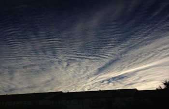
©Elizabeth Smyth
_______________________
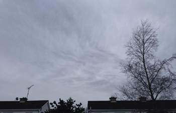
Cirrostratus (Cs)
A thin continuous layer of cirrus through which the sun is visible, causing optical phenomena such as a halo, mock sun, sun pillar, etc. This cloud is the first sign of an approaching warm front, and is followed by altostratus and eventually nimbostratus.
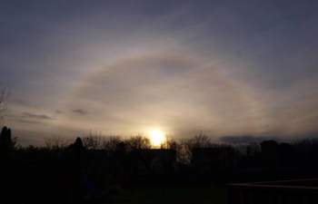
© Patrick Mullins
_______________________
Mid-level Clouds
Altocumulus (Ac)
A mid-level (2,000 – 4,000 m) cumulus cloud, white or grey in colour, with some shading visible in parts. It can occur in sheets (Altocumulus stratiformus), or as individual clouds, with each cloud being smaller than low-level cumulus but larger than Cirrocumulus.
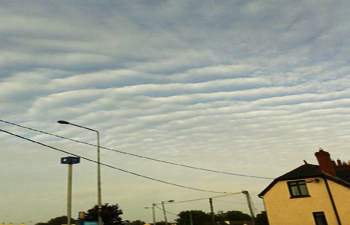
© Moria Vorster
_______________________
Altostratus (As)
An extensive and essentially uniform mid level layer cloud of varying opacity. It generally forms when a humid but stable air mass is forced to slowly rise ahead of an approaching warm front. While it can produce some precipitation this tends to evaporate before reaching the ground.
© Maggie Boate
_______________________
Nimbostratus (Ns)
Densely layered cloud that produces widespread precipitation. It normally develops from thickening Altostratus on the approach of large-scale weather systems such as a warm or occluded front. Although classed as a mid-level cloud, it will occasionally be observed at lower levels as the frontal zone it is associated with moves over.
© Rodney Cleary
_______________________
Low-level Clouds
Cumulus (Cu)
Fluffy, heaped clouds, with flat bases and generally well-defined edges. They form when warm air parcels rise and cool to their dewpoint, allowing saturation to occur. They are generally associated with fair weather, although they can develop vertically into Cumulonimbus (Cb) if the atmosphere is unstable enough.
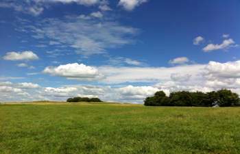
© Philip Wall
_______________________
Stratocumulus (Sc)
Generally a low, flat based cloud of light vertical extent which defines it from the more featureless stratus forms. They commonly form from either the break up of stratus or the spreading out of cumulus and is a good indicator that the atmospheric conditions are relatively stable. Like stratus, stratocumulus is one of the more common cloud forms observed over Ireland

© Madeleine McKeown
_______________________
Stratus (St)
Stratus comes from the Latin for layer, and it is just that – any type of flat, layered cloud. Unlike cumuluform clouds, it forms through the very slow rising of an air mass, or by radiative cooling of a warm humid air mass over cooler terrain. It is a pain in the backside of the Irish as it is our most common type of cloud and the reason why more than half of the year is overcast.
© Laura Jan Neakon
_______________________
Descriptions by Fergal Tierney, Ian Carruthers, Patrick Gordon & Peter O’Donnell
Photos by IWO Contributors
